 vesseltracker.com
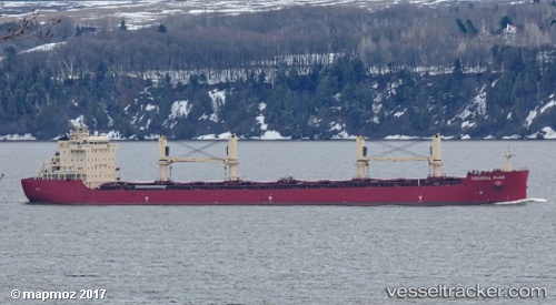
Vessel Federal Ruhr IMO: 9766176, MMSI: 538008902 Bulk Carrier
UTC, 35.83833, -0.60833, course: -1, speed: 1
UTC, 35.85153, -0.57353, course: 236, speed: 2.3
2026-02-14 23:22:50 UTC, 35.83143, -0.59480, course: 11, speed: 1.8
Live AIS position:
UTC. Near Canastel),
updated 2026-02-14 23:22:50 UTC.
Find the position of the vessel Federal Ruhr on the map. The latter are known coordinates and path.
marine traffic ship tracker show on live map
The current position of vessel Federal Ruhr is 35.83143 lat / -0.59480 lng. Updated: 2026-02-14 23:22:50 UTCCurrently sailing under the flag of Marshall Islands
Details:
Last coordinates of the vessel:
UTC, 35.80372, -0.59059, course: 331, speed: 3.3UTC, 35.83833, -0.60833, course: -1, speed: 1
UTC, 35.85153, -0.57353, course: 236, speed: 2.3
2026-02-14 23:22:50 UTC, 35.83143, -0.59480, course: 11, speed: 1.8